

- Home
- Map
Map

Access map
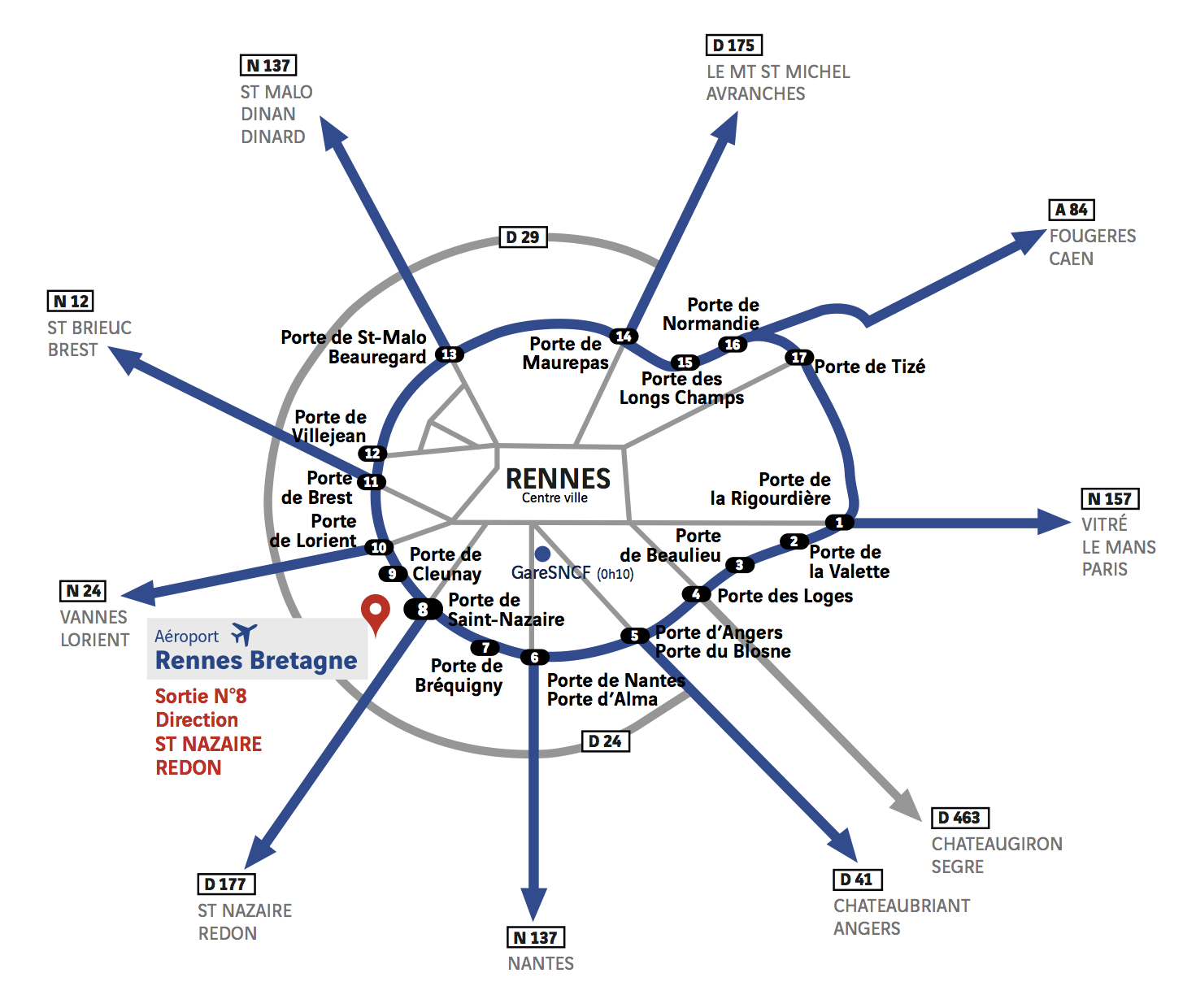
Rennes Bretagne Airport is easy to reach via the motorway network. It is located 10 minutes from the town centre, 50 minutes from Laval, Saint-Malo and Redon and 1 hour from Saint-Brieuc and Vannes, via the motorway network.
On the ring road, take the n°8 exit towards Saint-Nazaire. The airport can be reached via the D29 and D34 main roads, following signs to “Parc Expo”.
GPS coordinates: 48.0686257,-1.7253652
Work information
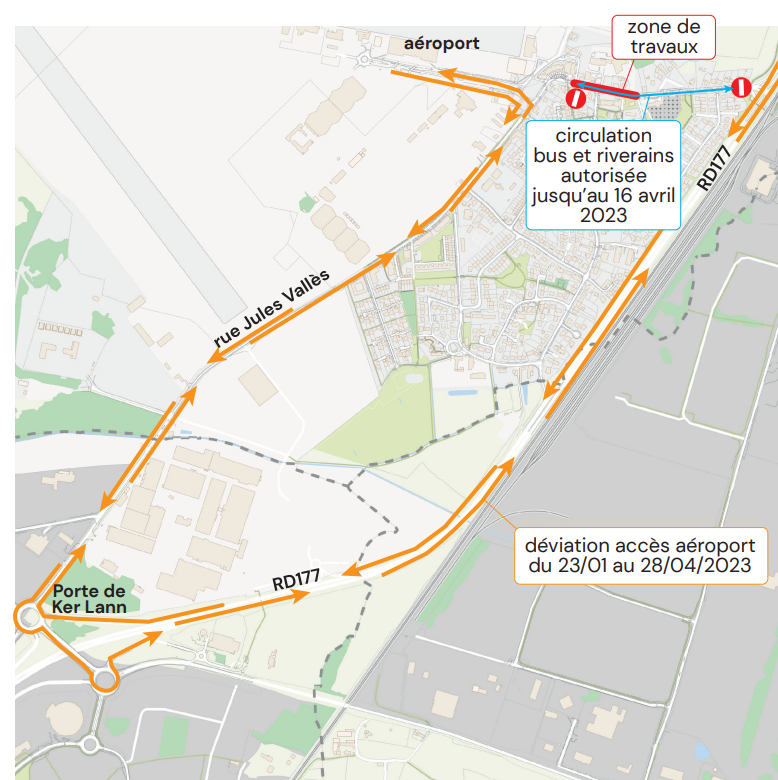
Rennes Métropole is currently carrying out development work on Boulevard Eugène Pottier. A final phase concerning the road repair work remains to be carried out from Monday April 17 to Friday April 28, 2023 (Easter school holidays).
During this period, traffic on all of Boulevard Eugène Pottier will be prohibited.
Access to the airport will be for all vehicles via the RD 177, the Ker Lann exit and rue Jules Valles. This route will be marked by the metropolitan road services.
For more information, visit the website travaux.rennesmetropole.fr
Airport parking plan
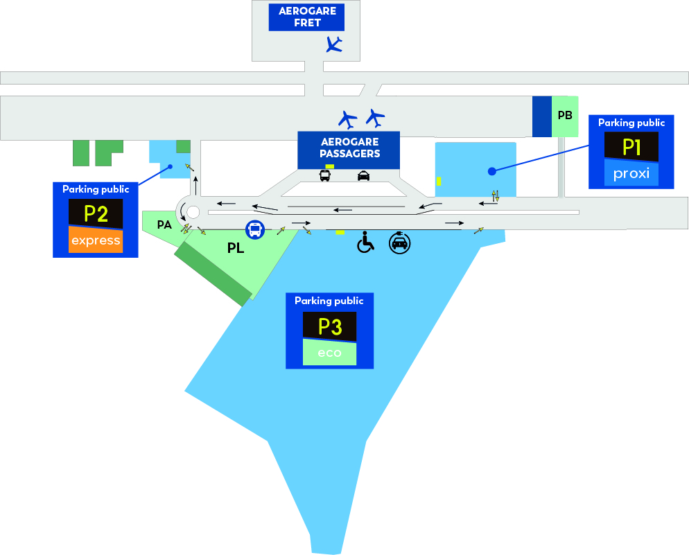
New : 200 additional spaces in the P3 car park.